
�������: 1-15 ���鵽������ѧ���� imaging����ؼ�¼112�� . ��ѯʱ��(0.093 ��)
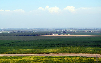
Researchers use satellite imaging to map groundwater use in California's Central Valley��ͼ��
satellite imaging map groundwater California Central Valley
2020/10/16
Researchers at the University of California, San Diego report a new way to improve groundwater monitoring by using a remote sensing technology, known as InSAR (interferometric synthetic aper...
A NOVEL TECHNIQUE FOR PRECISION GEOMETRIC CORRECTION OF JITTER DISTORTION FOR THE EUROPA IMAGING SYSTEM AND OTHER ROLLING-SHUTTER CAMERAS
Europa photogrammetry jitter geometric correction active-pixel sensors
2018/5/14
We use simulated images to demonstrate a novel technique for mitigating geometric distortions caused by platform motion (��jitter��) as two-dimensional image sensors are exposed and read out line by lin...
HIGH-RESOLUTION TOPOGRAPHY OF MERCURY FROM MESSENGER ORBITAL STEREO IMAGING �C THE SOUTHERN HEMISPHERE QUADRANGLES
Mercury MESSENGER Digital Terrain Models
2018/5/15
We produce high-resolution (222 m/grid element) Digital Terrain Models (DTMs) for Mercury using stereo images from the MESSENGER orbital mission. We have developed a scheme to process large numb...
STUDY ON HIGH RESOLUTION MEMBRANE-BASED DIFFRACTIVE OPTICAL IMAGING ON GEOSTATIONARY ORBIT
Diffractive Optics Deployable Achromatic Geostationary Orbit High Resolution Membrane
2017/7/12
Diffractive optical imaging technology provides a new way to realize high resolution earth observation on geostationary orbit. There are a lot of benefits to use the membrane-based diffractive optical...
GF-7 IMAGING SIMULATION AND DSM ACCURACY ESTIMATE
GF-7 Imaging Simulation WorldView-2 DSM Accuracy Estimate
2017/7/12
GF-7 satellite is a two-line-array stereo imaging satellite for surveying and mapping which will be launched in 2018. Its resolution is about 0.8 meter at subastral point corresponding to a 20 k...
ON THE DESIGN OF HIGH RESOLUTION IMAGING SYSTEMS
Digital High resolution Sensor systems Satellite Modelling Design Space Technology
2017/7/12
The design of high-resolution systems is always a consideration of many parameters. Technological parameter of the imaging system, e.g. diameter of the imaging system, mass and power, as well as stora...
FUSION OF LASER ALTIMETRY DATA WITH DEMS DERIVED FROM STEREO IMAGING SYSTEMS
Ice Sheet Surface Elevation Changes Fusion System Mass Balance Changes
2016/11/30
During the last two decades surface elevation data have been gathered over the Greenland Ice Sheet (GrIS) from a variety of different sensors including spaceborne and airborne laser altimetry, such as...
EVALUATION OF VARIOUS SPECTRAL INPUTS FOR ESTIMATION OF FOREST BIOCHEMICAL AND STRUCTURAL PROPERTIES FROM AIRBORNE IMAGING SPECTROSCOPY DATA
Airborne imaging spectroscopy DART Chlorophyll content Continuum removal Leaf area index Forest Support vector regression Radiative transfer modelling
2016/11/24
In this study we evaluated various spectral inputs for retrieval of forest chlorophyll content (Cab) and leaf area index (LAI) from high spectral and spatial resolution airborne imaging spectroscopy d...
ACCOUNTING FOR VARIANCE IN HYPERSPECTRAL DATA COMING FROM LIMITATIONS OF THE IMAGING SYSTEM
Supervised classification decorrelation Mahalanobis distance Signal-to-noise ratio (SNR) Bayesian approach Principal component analysis Pixel-wise calibration
2016/11/23
Over the course of the past few years, a number of methods was developed to incorporate hyperspectral imaging specifics into generic data mining techniques, traditionally used for hyperspectral data p...
A REVIEW OF HYPERSPECTRAL IMAGING IN CLOSE RANGE APPLICATIONS
Hyperspectral TLS Lidar Close-Range Geology Geoscience Visualisation Integration
2016/11/11
Hyperspectral imaging is an established method for material mapping, which has been conventionally applied from airborne and spaceborne platforms for a range of applications, including mineral and veg...
Toward an Automatic Calibration of Dual Fluoroscopy Imaging Systems
Dual Fluoroscopy Biplanar Videoradiography Photogrammetric Calibration Target Extraction
2016/11/11
High-speed dual fluoroscopy (DF) imaging provides a novel, in-vivo solution to quantify the six-degree-of-freedom skeletal kinematics of humans and animals with sub-millimetre accuracy and high tempor...
GEOMORPHOLOGICAL MAPPING WITH TERRESTRIAL LASER SCANNING AND UAV-BASED IMAGING
Terrestrial laser scanning UAV-based imaging 3D data Digital elevation model High-resolution mapping Karst landscape Surface monitoring
2016/11/11
High-resolution digital elevation models (DEMs) are useful for the detailed mapping of geomorphological features. Nowadays various sensors and platforms are available to collect 3D data. The presented...
ADVANCED TIE FEATURE MATCHING FOR THE REGISTRATION OF MOBILE MAPPING IMAGING DATA AND AERIAL IMAGERY
Mobile Mapping Orientation Accuracy Estimation Feature Matching Template Matching
2016/7/5
Mobile Mapping��s ability to acquire high-resolution ground data is opposing unreliable localisation capabilities of satellite-based positioning systems in urban areas. Buildings shape canyons impeding...
SYSTEMATIC CALIBRATION FOR A BACKPACKED SPHERICAL PHOTOGRAMMETRY IMAGING SYSTEM
Mobile Mapping System Calibration Spherical Photogrammetry
2016/7/5
A spherical camera can observe the environment for almost 720 degrees�� field of view in one shoot, which is useful for augmented reality, environment documentation, or mobile mapping applications. Thi...
HIGH RESOLUTION AIRBORNE LASER SCANNING AND HYPERSPECTRAL IMAGING WITH A SMALL UAV PLATFORM
payload integration unmanned aerial system UAV/VTOL LiDAR 3D mapping terrain model point density
2016/7/5
The capabilities of unmanned airborne systems (UAS) have become diverse with the recent development of lightweight remote sensing instruments. In this paper, we demonstrate our custom integration of t...
�й��о����������а�-��
- ���ڼ���...
�й�ѧ���ڿ����а�-��
- ���ڼ���...
�����ѧ���л������а�-��
- ���ڼ���...
�й���ѧ���а�-��
- ���ڼ���...
�ˡ���-ƪ
- ���ڼ���...
�Ρ���-ƪ
- ���ڼ���...
��������-ƪ
- ���ڼ���...
�������� -ƪ
- ���ڼ���...
֪ʶҪ��-ƪ
- ���ڼ���...
���ʶ�̬-ƪ
- ���ڼ���...
��������-ƪ
- ���ڼ���...
ѧ��ָ��-ƪ
- ���ڼ���...
ѧ��վ��-ƪ
- ���ڼ���...