搜索结果: 1-15 共查到“光学工程 System”相关记录188条 . 查询时间(0.156 秒)

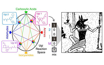
Researchers report progress on molecular data storage system(图)
Researchers report progress molecular data storage system
2020/2/20
A team of National Science Foundation-funded researchers has made substantial progress in creating a new type of data storage system.As the data universe continues to expand, much work is being done t...
INCREASING AWARENESS FOR URBAN CULTURAL HERITAGE BASED ON 3D NARRATIVE SYSTEM
3D narrative system urban cultural heritage tangible heritage
2018/11/9
As UNESCO World Heritage Center defined, cultural heritage is legacy of physical artefacts and intangible attributes of a group or society that are inherited from past generations, maintained in the p...
EXTRACTING 3D SEMANTIC INFORMATION FROM VIDEO SURVEILLANCE SYSTEM USING DEEP LEARNING
3-D space Camera calibration Target recognition Target tracking
2018/5/16
At present, intelligent video analysis technology has been widely used in various fields. Object tracking is one of the important part of intelligent video surveillance, but the traditional target tra...
A THREE-DIMENSIONAL AEROSOL VARIATIONAL DATA ASSIMILATION SYSTEM FOR AIRCRAFT AND SURFACE OBSERVATIONS
Data assimilation WRF/Chem Aerosol Aircraft
2018/5/16
A three-dimensional variational data assimilation system is implemented within the Weather Research and Forecasting/Chemistry model, and the control variables consist of eight species of the Model for...
INVESTIGATION OF GEOMETRIC PERFORMANCE OF AN INDOOR MOBILE MAPPING SYSTEM
Mobile Laser Scanning Evaluation Viametris iMS3D Point Cloud Indoor Modeling
2018/6/4
Up-to-date and reliable 3D information of indoor environments is a prerequisite for many location- based services. One possibility to capture the necessary 3D data is to make use of Mobile Mapping Sys...
USAGE OF MULTIPLE LIDAR SENSORS ON A MOBILE SYSTEM FOR THE DETECTION OF PERSONS WITH IMPLICIT SHAPE MODELS
LiDAR Mobile Laser scanning MLS Person Detection Classification
2018/6/4
The focus of this paper is the processing of data from multiple LiDAR (light detection and ranging) sensors for the purpose of detecting persons in that data. Many LiDAR sensors (e.g., laser scanners)...
2017SPIE光学系统装调、公差和验证专题会议(Optical System Alignment,Tolerancing,and Verification XI)
2017 SPIE 光学系统装调、公差和验证 专题会议
2017/4/25
2017SPIE光学系统装调、公差和验证专题会议(Optical System Alignment,Tolerancing,and Verification XI)。
High density holographic versatile disc (HVD) system using collinear technologies
optical data storage system optical memory volumetric recording holography
2016/11/22
Collinear Holography was proposed by OPTWARE Corporation, in which the information and reference beams were aligned co-axially and modulated by the same SLM. With this unique configuration the optical...
performance analysis of altm3100ea system:instrument specifications and accuracy of lidar data
LiDAR laser scanning DEM/DTM accuracy performance
2015/9/1
Over the last decade the number of airborne lidar systems currently deployed and operating in the field has grown impressively.This growth has intensified the level of competition among lidar equipmen...
an integrated on-board laser range sensing system for on-the-way city and road modelling
Three-dimensional Laser Scanning GPS/INS Geometric Modelling
2015/9/1
Precise realistic models of outdoor environments such as cities and roads are useful for various applications. However, for a high level of detail, and a large size of environment to be digitized, one...
A HYBRID DECISION SUPPORT SYSTEM FOR 3D CITY PLANNING
Decision Support System Spatial Planning Hybrid System Virtual Reality
2015/8/31
In recent years virtual reality based geographic information systems (VRGIS) have been employed successfully to accomplish city
planning tasks. Tracking technologies and stereoscopic visualization of...
Optimal requirements of a data acquisition system for a quadrupolar probe used in resistivity and permittivity surveys
Instrumentation and techniques of general interest Magnetic and electrical methods Mathematical geophysics Data processing
2015/8/28
This report discusses the development and engineering of a suitable quadrupolar probe for simultaneous and noninvasive surveys of electrical resistivity and dielectric permittivity. The quadrupolar pr...
Opto-mechanical combination of a line scanning camera and a micro laserscanner system
Panoramic camera laser scanner optical path field lens
2015/8/25
Line scanning cameras are used in photogrammetric applications to record images with a very high resolution and a field of view up to 360° horizontally. In order to generate 3D information more than o...
Evaluation of image based integrated measurement system and its application to topographic survey
Photogrammetry Calibration Digital Camera Laser Integration Non-contact
2015/8/25
A convenient 3D measurement using amateur digital camera is enormously expected in various fields with appearance of the low cost and high-resolution amateur digital cameras. In these circumstances, t...
CONSTRUCTION AND APPLICATION OF SATELLITE IMAGE 3D PRESENTATION SYSTEM FOR EDUCATION
DEM/DTM Infrared Internet Land Cover
2015/8/24
A system to provide data sets for 3D presentation of the Landsat image for any part of Japan and their viewer are constructed, and
uploaded as the SiPSE homepage in the Internet with the address htt...

