搜索结果: 1-15 共查到“Observation”相关记录393条 . 查询时间(0.156 秒)
新疆生地所在International Journal of Applied Earth Observation and Geoinformation发文提出将PesRec方法用于单张图像的室内语义场景重建
空间结构 鲁棒
2024/10/14
在增强现实和虚拟现实中,室内语义场景重建是一项具有挑战性的任务。由于室内场景的复杂性和遮挡问题,场景重建的质量受到限制。主要是因为难以估计场景的空间结构以及对物体位置推断的学习不足。

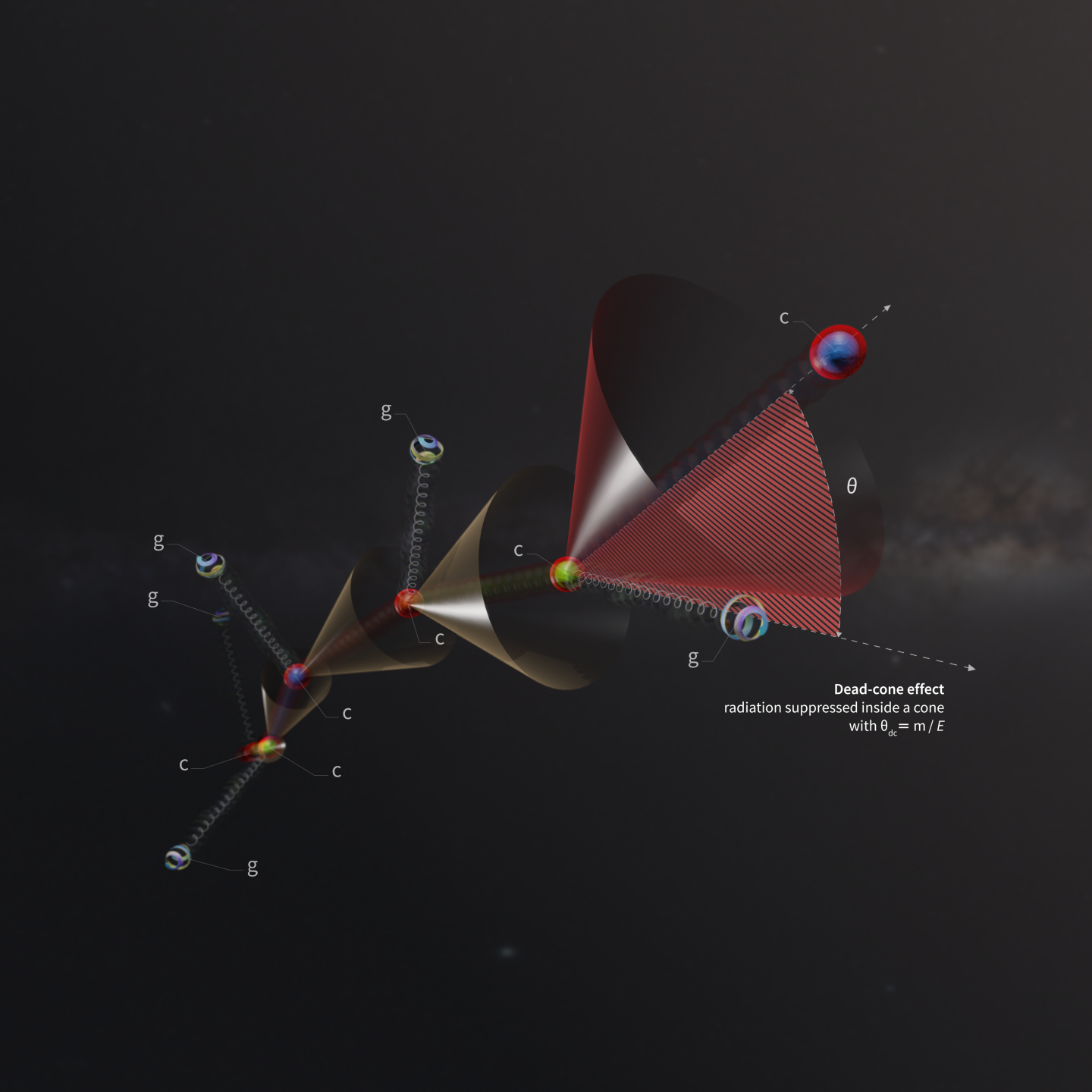
ALICE makes first direct observation of a fundamental effect in particle physics(图)
ALICE particle physics fundamental effect charm quark
2022/6/27

Direct observation of water clusters for surface design
Water cluster Vapor condensation Attenuated total reflection IR Surface structure
2023/3/1
Engineered surfaces for water collection have been intensively investigated. However, microscopic mechanism of condensation on structural surfaces is rarely explored and it's always a challenge to obs...
中国地质大学科学技术发展院苟启洋,徐尚,郝芳等,资源学院/构造与油气资源教育部重点实验室. Energy(December 2020), The effect of tectonic deformation and preservation condition on the shale pore structure using adsorption-based textural quantification and 3D image observation
构造作用;保存条件;有机质;页岩;微纳米;孔隙;发育演化
2021/10/15
近日,中国地质大学资源学院博士生苟启洋在国际著名能源地质学期刊《Energy》上刊发研究成果,该成果主要揭示了构造作用和保存条件对富有机质页岩微纳米孔隙发育演化的控制作用,探讨了不同孔隙结构背景下页岩储层压裂改造效果。
重庆医科大学人体显微形态学实验课件2 The Observation On The Organelle
重庆医科大学 人体显微形态学 实验 The Observation Organelle
2019/8/2
重庆医科大学人体显微形态学实验课件2 The Observation On The Organelle。
CHALLENGES IN OPERATIONS AND MAINTENANCE OF ANTARCTICA GROUND STATION FOR EARTH OBSERVATION SATELLITES
Data Reception system (DRS) Data Communication System (DCS) Payload (PLD) Telemetry and Tele-Command (TTC) Visible Orbits
2019/2/27
Remote sensing and Geographical Information System (GIS) through Earth Observation (EO) Satellites have become most important tools for many of the societal applications of day-to-day life, during the...
IDENTIFICATION OF POTENTIAL ZONES FOR KIMBERLITE EXPLORATION – AN EARTH OBSERVATION APPROACH
Alteration, ASTER, EIGEN6C4 Geomorphic anomaly Kimberlite Logical Operator Lithology Lineamen
2019/2/27
n the present study, we have prepared the thematic evidence layers for identifying the potential zones of kimberlite emplacement in parts of Chhatarpur district, Madhya Pradesh. These thematic layers ...
MULTI-SATELLITE OBSERVATION OF MEGH CYCLONE
Cyclone Megh RISAT-1 Synthetic aperture radar cloud microphysics Wind speed
2019/2/28
Cyclone Megh, a category-3 (Saffir-Simpson scale) cyclonic storm is regarded as the worst tropical cyclone to ever strike Yemen’s island of Socotra. In this paper, we aim to investigate the wind struc...
OBSERVATION OF DUST LOADINGS FROM SPACE-BORNE MEASUREMENTS (2005–2016)
AOD AAOD North Africa Middle-East
2019/2/28
Dust particles of different size and origins, form major part of air pollution in the atmosphere. The qualitative and quantitative estimates of dust from ground-based measurements provide accurate inf...
RETRIEVAL OF AEROSOL PHASE FUNCTION AND POLARIZED PHASE FUNCTION FROM POLARIZATION OF SKYLIGHT FOR DIFFERENT OBSERVATION GEOMETRIES
Aerosol Polarization Phase function Polarized phase function Retrieval Sun-sky radiometer
2018/5/14
The phase function and polarized phase function are important optical parameters, which describe scattering properties of atmospheric aerosol particles. Polarization of skylight induced by the scatter...
RESEARCH ON OPTIMAL OBSERVATION SCALE FOR DAMAGED BUILDINGS AFTER EARTHQUAKE BASED ON OPTIMAL FEATURE SPACE
Optimal Feature Space Damaged Buildings ESP Scale Accuracy
2018/5/11
A new information extraction method of damaged buildings rooted in optimal feature space is put forward on the basis of the traditional object-oriented method. In this new method, ESP (estimate of sca...
MULTI-SATELLITE OBSERVATION SCHEDULING FOR LARGE AREA DISASTER EMERGENCY RESPONSE
Disaster Emergency Response Area Tasks Decomposition Multi-satellite Scheduling Multi-objective Genetic Algorithm
2018/5/15
an optimal imaging plan, plays a key role in coordinating multiple satellites to monitor the disaster area. In the paper, to generate imaging plan dynamically according to the disaster relief, we prop...
SPACE-AIR-GROUND CO-OBSERVATION IN WATERSHED MANAGEMENT: THE ESTABLISHMENT OF SYSTEM
remote sensing dynamic monitoring water administration law watershed management
2018/5/17
To realize real-time, detailed, and standardized watershed monitoring and management, a dynamic monitoring system is proposed, at all levels (space, air, and ground), by comprehensively utilizing adva...
HIMAWARI-8 GEOSTATIONARY SATELLITE OBSERVATION OF THE INTERNAL SOLITARY WAVES IN THE SOUTH CHINA SEA
Himawari-8 Advanced Himawari Imager Internal Solitary Waves South China Sea
2018/5/14
The new generation geostationary meteorological satellite, Himawari-8 (H-8), was launched in 2015. Its main payload, the Advanced Himawari Imager (AHI), can observe the earth with 10-minute interval a...


