
ЫбЫїНсЙћ: 46-60 ЙВВщЕНЁАЙЄбЇ GISЁБЯрЙиМЧТМ1560Ьѕ . ВщбЏЪБМф(0.328 Уы)
INTEGRATION OF GIS AND BIM TECHNIQUES IN CONSTRUCTION PROJECT MANAGEMENT ЈC A REVIEW
Building Information Modeling (BIM) Geographic Information System (GIS) Construction Industry
2018/11/9
Construction industry has become much more complex due to the large number of people and documentations involved. As a result, the full process of building construction may involve with many different...
GIS AND BIM INTEGRATION AT DATA LEVEL: A REVIEW
GIS BIM CityGML IFC data Integration models
2018/11/9
City Geography Markup Language (CityGML) and Industry Foundation Class (IFC) are the two most popular data exchange format for the integration of Geographic Information System (GIS) and Building Infor...
ROOFING ASSESSMENT FOR ROOFTOP RAINWATER HARVESTING ADOPTION USING REMOTE SENSING AND GIS APPROACH
Remote sensing GIS, rooftop rainwater harvesting geospatial environment
2018/11/8
Rooftop rainwater harvesting refers to the collection and storage of water from rooftops whereby the quality of harvested rainwater depend on the types of roof and the environmental conditions. This s...
INVESTIGATING THE NATIONAL DIGITAL CADASTRAL DATABASE (NDCDB) DATA HANDLING WITHIN GIS APPLICATIONS
National Digital Cadastral Database Multi-case study patial analysis
2018/11/8
This paper explains the investigation carried out to understand NDCDB data handling within GIS applications. The method used was a case study replicated to five established GIS applications from diffe...
дкЗжЮіФЉжЦЕМРзДяЫбЫїЛњРэЕФЛљДЁЩЯЃЌДгеНЪѕНЧЖШЗНУцЬсГіСЫвЛжжЛљгкGISЃЈЕиРэаХЯЂЯЕЭГЃЉЖдЕКАЖИННќФПБъЫбЫїЕФЗНЗЈЃЌЙЙНЈСЫЗДНЂЕМЕЏЖдЕКАЖИННќФПБъЫбЫїФЃаЭЃЌВЂеыЖдЕфаЭЪЕР§НјааСЫЗТецМЦЫуЁЃИУЗНЗЈЖдРзДяЫбЫїдРэЩшМЦКЭЗДНЂЕМЕЏзїеНЪЙгУОпгавЛЖЈЕФНшМјвтвхЁЃ
ФЯОЉЙЄвЕДѓбЇ2019ФъЫЖЪППМЪдЕиРэаХЯЂЯЕЭГЃЈGISЃЉдРэДѓИй
ФЯОЉЙЄвЕДѓбЇ 2019Фъ ЫЖЪППМЪд ЕиРэаХЯЂЯЕЭГ дРэДѓИй
2019/5/22
ФЯОЉЙЄвЕДѓбЇ2019ФъЫЖЪППМЪдЕиРэаХЯЂЯЕЭГЃЈGISЃЉдРэДѓИйЁЃ
РЅУїРэЙЄДѓбЇ2016ФъЫЖЪПбаОПЩњеаЩњШыбЇПМЪдGISдРэМАгІгУзЈвЕЪдЬт
РЅУїРэЙЄДѓбЇ 2016Фъ ЫЖЪПбаОПЩњ еаЩњШыбЇПМЪд GISдРэМАгІгУ зЈвЕЪдЬт
2019/12/17
РЅУїРэЙЄДѓбЇ2016ФъЫЖЪПбаОПЩњеаЩњШыбЇПМЪдGISдРэМАгІгУзЈвЕЪдЬтЁЃ
РЅУїРэЙЄДѓбЇ2017ФъЫЖЪПбаОПЩњеаЩњШыбЇПМЪдGISдРэМАгІгУзЈвЕЪдЬт
РЅУїРэЙЄДѓбЇ 2017Фъ ЫЖЪПбаОПЩњ еаЩњШыбЇПМЪд GISдРэМАгІгУ зЈвЕЪдЬт
2019/12/18
РЅУїРэЙЄДѓбЇ2017ФъЫЖЪПбаОПЩњеаЩњШыбЇПМЪдGISдРэМАгІгУзЈвЕЪдЬтЁЃ
РЅУїРэЙЄДѓбЇ2018ФъЫЖЪПбаОПЩњеаЩњШыбЇПМЪдGISдРэМАгІгУAОэзЈвЕЪдЬт
РЅУїРэЙЄДѓбЇ 2018Фъ ЫЖЪПбаОПЩњ еаЩњШыбЇПМЪд GISдРэМАгІгУAОэ зЈвЕЪдЬт
2019/12/20
РЅУїРэЙЄДѓбЇ2018ФъЫЖЪПбаОПЩњеаЩњШыбЇПМЪдGISдРэМАгІгУAОэзЈвЕЪдЬтЁЃ
HIGH-LEVEL-OF-DETAIL SEMANTIC 3D GIS FOR RISK AND DAMAGE REPRESENTATION OF ARCHITECTURAL HERITAGE
Cultural Heritage Semantic 3D Model Database
2018/11/9
The need to share information about architectural heritage effectively after a disaster event, in order to foster its preservation, requires the use of a common language between the involved actors an...
HOW CAN 3D GIS BE USED TO BETTER STORE, INTEGRATE AND COMMUNICATE RESULTS OF ENVIRONMENTAL IMPACT ASSESSMENTS?
3D GIS GIS environmental datasets Environmental Impact Assessment
2018/11/9
In the United Kingdom, the process of conducting the Environmental Impact Assessment (EIA) is a legal requirement for projects of considerable size or those that can affect the environment. EIA result...
GLOBE BASED 3D GIS SOLUTIONS FOR VIRTUAL HERITAGE
Cultural Heritage WebGIS WebGL Globe application Virtual Reality Virtual Heritage
2018/11/9
During the last years, many solutions have been proposed for 3D Virtual Heritage representations. Recently, also new technologies for online gaming evolved, based on javascript libraries (WebGL), used...
BIM-GIS ORIENTED INTELLIGENT KNOWLEDGE DISCOVERY
Smart City Knowledge discovery BIM GIS Fuzzy Reasoning Rules Extraction
2018/11/9
Urban and population growth results in increasing pressure on the public utilities like transport, energy, healthcare services, crime management and emergency services in the realm of smart city manag...
КгФЯДѓбЇОйАьШЋЙњИпаЃЁЖWeb GISдРэгыММЪѕЁЗПЮГЬбаЬжЛсЃЈЭМЃЉ
КгФЯДѓбЇ ИпаЃ Web GISдРэгыММЪѕ ПЮГЬбаЬжЛс
2018/8/13
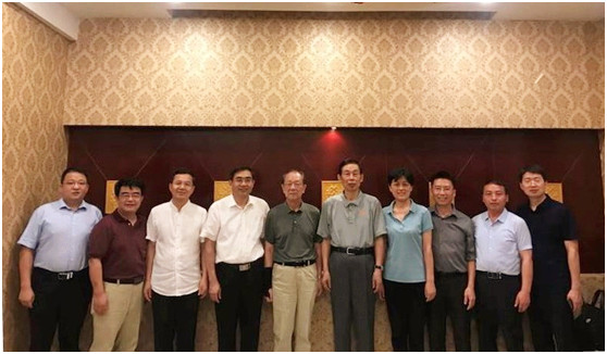
2018Фъ8дТ1Ше-4ШеЃЌШЋЙњИпаЃЁЖWeb GISдРэгыММЪѕЁЗПЮГЬбаЬжЛсдкЮваЃЛЗОГгыЙцЛЎбЇдКЖўТЅБЈИцЬќОйааЁЃЛсвщгЩEsriжаЙњЁЂИпЕШНЬг§ГіАцЩчЁЂКгФЯДѓбЇСЊКЯжїАьЃЌКгФЯДѓбЇЛЗОГгыЙцЛЎбЇдКГаАьЁЃжјУћЕиРэаХЯЂПЦбЇзЈМвЫяОХСждКЪПЁЂЭѕМввЋдКЪПЃЌУРЙњЛЗОГЯЕЭГбаОПЫљЃЈEsriЃЉЯюФПжїЙмЁЂЙњМЪЛЊШЫЕиРэаХЯЂПЦбЇаЛсЃЈCPGISЃЉЧАШЮжїЯЏИЖЦЗЕТНЬЪкЃЌEsriжаЙњЧјИБзмВУЁЂЪзЯЏзЩбЏзЈМвВЬЯўБјИпМЖЙЄГЬЪІЃЌММЪѕзЈМвВЬОЉОЇИп...
ADDING 3D GIS VISUALIZATION AND NAVIGATION TO THE SPARQL QUERY LOOP
3D visualization, geospatial data, Linked Data, SPARQL, REPL, data analytics
2018/11/8
3D environments allow advanced spatial navigation and visualization, but have traditionally provided limited support for performing non-spatial data analysis operations like filtering, joining, and in...
жаЙњбаОПЩњНЬг§ХХааАё-Ьѕ
- е§дкМгди...
жаЙњбЇЪѕЦкПЏХХааАё-Ьѕ
- е§дкМгди...
ЪРНчДѓбЇПЦбаЛњЙЙХХааАё-Ьѕ
- е§дкМгди...
жаЙњДѓбЇХХааАё-Ьѕ
- е§дкМгди...
ШЫЁЁЮя-ЦЊ
- е§дкМгди...
ПЮЁЁМў-ЦЊ
- е§дкМгди...
ЪгЬ§зЪСЯ-ЦЊ
- е§дкМгди...
баеазЪСЯ -ЦЊ
- е§дкМгди...
жЊЪЖвЊЮХ-ЦЊ
- е§дкМгди...
ЙњМЪЖЏЬЌ-ЦЊ
- е§дкМгди...
ЛсвщжааФ-ЦЊ
- е§дкМгди...
бЇЪѕжИФЯ-ЦЊ
- е§дкМгди...
бЇЪѕеОЕу-ЦЊ
- е§дкМгди...