
ЫбЫїНсЙћ: 106-120 ЙВВщЕНЁАЙЄбЇ GISЁБЯрЙиМЧТМ1559Ьѕ . ВщбЏЪБМф(0.838 Уы)
РЅУїРэЙЄДѓбЇ2016ФъЫЖЪПбаОПЩњеаЩњШыбЇПМЪдGISдРэМАгІгУЪдЬт
РЅУїРэЙЄДѓбЇ 2016Фъ ЫЖЪПбаОПЩњ еаЩњ ШыбЇПМЪд GISдРэМАгІгУ ЪдЬт
2016/10/26
РЅУїРэЙЄДѓбЇ2016ФъЫЖЪПбаОПЩњеаЩњШыбЇПМЪдGISдРэМАгІгУЪдЬтЁЃ
РЅУїРэЙЄДѓбЇ2017ФъЫЖЪПбаОПЩњШыбЇПМЪдGISдРэМАгІгУПМЪдДѓИй
РЅУїРэЙЄДѓбЇ 2017Фъ ЫЖЪПбаОПЩњ ШыбЇПМЪд GISдРэ ПМЪдДѓИй
2016/10/26
РЅУїРэЙЄДѓбЇ2017ФъЫЖЪПбаОПЩњШыбЇПМЪдGISдРэМАгІгУПМЪдДѓИйЁЃ
гЭЬяЕиУцЙЄГЬИїзЈвЕЙцЛЎЩшМЦШЫдБЙЄзїЪБашвЊдквдЕиаЮгАЯёЮЊЛљДЁЕФЭМжНЩЯЪжЙЄНјааВњФмНЈЩшЙцЛЎЩшМЦВЂЭЈЙ§ЯжГЁПМВьКЫЪЕМфЁЂеОФмСІЁЃгЭЬяИЈжњЙцЛЎЩшМЦЯЕЭГгІгУGISММЪѕНЋзЈвЕЭМаЮЪ§ОнгыЕиаЮЭМЪ§ОнНсКЯЃЌЮЊВЛЭЌзЈвЕЕФЙцЛЎЩшМЦгУЛЇЬсЙЉаЭЌАьЙЋЦНЬЈЁЃЛљгкИУЯЕЭГЃЌВЛЭЌзЈвЕЕФЙцЛЎЩшМЦгУЛЇПЩаЭЌЩшМЦЃЌМѕЩйЙцЛЎЩшМЦжмЦкЃЌЪЕЯжЙцЛЎЯрЙизЈвЕжЎМфЕчзгЛЏзЪСЯНЛНгЁЂЙцЛЎЭМжНЕФЕчзгДцЕЕКЭзЈЬтЭМЪфГіЃЌЬсИпСЫЙцЛЎЩшМЦЕФМАЪБадЁЃ
жаЙњПѓвЕДѓбЇЃЈББОЉЃЉ2017ФъЫЖЪПбаОПЩњШыбЇздУќЬтGISЛљДЁПМЪдДѓИй
жаЙњПѓвЕДѓбЇЃЈББОЉЃЉ 2017Фъ ЫЖЪПбаОПЩњ ШыбЇздУќЬт GISЛљДЁ ПМЪдДѓИй
2016/9/21
жаЙњПѓвЕДѓбЇЃЈББОЉЃЉ2017ФъЫЖЪПбаОПЩњШыбЇздУќЬтGISЛљДЁПМЪдДѓИйЁЃ
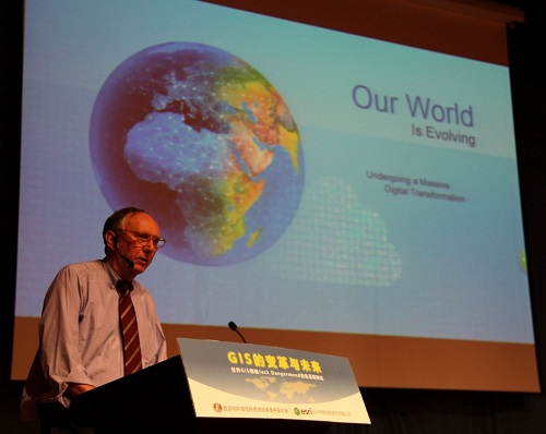
2016Фъ9дТ9ШеЃЌгІжаЙњПЦбЇдКЕиРэПЦбЇгызЪдДбаОПЫљзЪдДгыЛЗОГаХЯЂЯЕЭГЙњМвжиЕуЪЕбщЪвбћЧыЃЌEsriШЋЧђзмВУJack DangermondдкББОЉЙњМвЛсвщжааФвдGISЕФЗЂеЙЯжзДЁЂгІгУФЃЪНКЭДцдкаЮЬЌЕФБфЛЏЧїЪЦвдМАЮДРДЗЂеЙЗНЯђЮЊжїЬтзїСЫзЈЬтБЈИцЃЌВЂгыЬибћМЮБіКЭгыЛсШЫдБНјааСЫЩюШыНЛСїгыЖдЛАЁЃБОДЮТлЬГгЩжаЙњПЦбЇдКЕиРэПЦбЇгызЪдДбаОПЫљзЪдДгыЛЗОГаХЯЂЯЕЭГЙњМвжиЕуЪЕбщЪвТНЗцбаОПдБжїГжЃЌжаЙњПЦбЇдКЕиРэПЦбЇгызЪдДбаОПЫљ...
ИпжАдКаЃGISзЈвЕЗЂеЙУцСйЕФЮЪЬтгыЖдВп
ИпжАдКаЃ CIS ЮЪЬт ЖдВп
2016/12/7
ЮФжаеыЖдИпжАдКаЃCISзЈвЕЗЂеЙЕФЬиЕуЃЌвдИЪЫрЪЁФГИпжАдКаЃЮЊР§ЃЌДгзЪН№ЭЖШыЁЂЪІзЪЧщПіЁЂзЈвЕНЬВФЁЂаЃЦѓКЯзїЁЂЦѓвЕашЧѓЕШЗНУцГіЗЂЃЌЯъЯИВћЪіЦфдкЗЂеЙЙ§ГЬжагіЕНЕФЮЪЬтЃЌШЛКѓНсКЯЪЕМЪНЬбЇЧщПіЃЌЬсГіСЫНтОізшАCISзЈвЕЗЂеЙЮЪЬтЕФЖдВпЃЌЖдЭЌРрИпаЃгаВЮПМЁЂНшМјЕФМлжЕЁЃ
ЮФжаВЩгУCISММЪѕЪжЖЮЃЌвдТУгЮЪ§ОнКЭЛљДЁЕиРэаХЯЂЪ§ОнЮЊжЇГХЃЌЗжЮіТУгЮзЪдДЕФПеМфЗжВМЬиеїЁЂПЭдДЪаГЁРДдДКЭНЛЭЈЭјТЗзДПіМАЫќУЧжЎМфЕФЯрЛЅгАЯьЃЌНјЖјДгПеМфЕФЪгНЧбаОПКЭЗЂЯжЮЪЬтЃЌЖдБЯНкЕиЧјТУгЮвЕЗЂеЙОпгавЛЖЈВЮПММлжЕЁЃ
Earth Resources and Environmental Remote Sensing/GIS Applications
Earth Resources Environmental Remote Sensing
2016/7/28
Long range land surveillance is a critical need in numerous military and civilian security applications, such as threat detection, terrain mapping and disaster prevention. A key technology for land su...
MOBILE GIS: A TOOL FOR INFORMAL SETTLEMENT OCCUPANCY AUDIT TO IMPROVE INTEGRATED HUMAN SETTLEMENT IMPLEMENTATION IN EKURHULENI, SOUTH AFRICA
Mobile GIS occupancy audit informal settlements
2016/7/8
Upgrading and relocating people in informal settlements requires consistent commitment, good strategies and systems so as to improve the lives of those who live in them. In South Africa, in order to a...
This paper presents an endeavour of integration of GIS (Geographical Information System) and BIM (Building Information Modelling) for indoor geovisual analytics. The merits of two types of technologie...
IMPLEMENTATION OF KRIGING METHODS IN MOBILE GIS TO ESTIMATE DAMAGE TO BUILDINGS IN CRISIS SCENARIOS
Kriging methods Mobile GIS natural hazard
2016/7/8
In the paper an example for the application of kriging methods to estimate damage to buildings in crisis scenarios is introduced. Furthermore, the Java implementations for Ordinary and Universal Krigi...
ON-LINE GIS ANALYSIS AND IMAGE PROCESSING FOR GEOPORTAL KIELCE/POLAND DEVELOPMENT
GIS Geoportal Sentinel-2
2016/7/8
GIS databases are widely available on the Internet, but mainly for visualization with limited functionality; very simple queries are possible i.e. attribute query, coordinate readout, line and area me...
URBAN RAIN GAUGE SITING SELECTION BASED ON GIS-MULTICRITERIA ANALYSIS
Rain Gauge Site Selection Multicriteria
2016/7/8
With the increasingly rapid growth of urbanization and climate change, urban rainfall monitoring as well as urban waterlogging has widely been paid attention. In the light of conventional siting selec...
USING MCDA AND GIS FOR LANDFILL SITE SELECTION: CENTRAL DISTRICTS OF ANTALYA PROVINCE
Landfill site selection Antalya Multi Criteria Decision Analysis
2016/7/8
The aim of this study is to select new landfill sites in Antalya, Turkey which is the fifth biggest city according to the population, approximately 1.2 million. It is the first rank according to the p...
MULTI-CRITERIA GIS ANALYSES WITH THE USE OF UAVS FOR THE NEEDS OF SPATIAL PLANNING
UAV Spatial Analyses Planning System Monitoring of Changes in Space
2016/7/5
Utilization of Unmanned Aerial Systems (UAVs) in agriculture, forestry, or other environmental contexts has recently become common. However, in the case of spatial planning, the role of UAVs still see...
жаЙњбаОПЩњНЬг§ХХааАё-Ьѕ
- е§дкМгди...
жаЙњбЇЪѕЦкПЏХХааАё-Ьѕ
- е§дкМгди...
ЪРНчДѓбЇПЦбаЛњЙЙХХааАё-Ьѕ
- е§дкМгди...
жаЙњДѓбЇХХааАё-Ьѕ
- е§дкМгди...
ШЫЁЁЮя-ЦЊ
- е§дкМгди...
ПЮЁЁМў-ЦЊ
- е§дкМгди...
ЪгЬ§зЪСЯ-ЦЊ
- е§дкМгди...
баеазЪСЯ -ЦЊ
- е§дкМгди...
жЊЪЖвЊЮХ-ЦЊ
- е§дкМгди...
ЙњМЪЖЏЬЌ-ЦЊ
- е§дкМгди...
ЛсвщжааФ-ЦЊ
- е§дкМгди...
бЇЪѕжИФЯ-ЦЊ
- е§дкМгди...
бЇЪѕеОЕу-ЦЊ
- е§дкМгди...