搜索结果: 1-15 共查到“环境科学技术 STUDY”相关记录117条 . 查询时间(0.343 秒)


New study takes comprehensive look at marine pollution and human health(图)
marine pollution human health
2020/12/11
For centuries, the oceans have been viewed as an inexhaustible receptacle for the byproducts of human activity. Today, marine pollution is widespread and getting worse and, in most countries, poorly c...

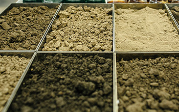
New study reveals that soil is a significant carbon sequestration driver(图)
soil significant carbon sequestration driver
2020/9/25
As harmful atmospheric carbon dioxide levels continue to increase, understanding the planet's carbon balance is increasingly important.A new report by U.S. National Science Foundation-funded ecol...
TWO-DIMENSIONAL LOESS LANDSLIDE DEFORMATION MONITORING WITH MULTIDIMENSIONAL SMALL BASELINE SUBSET (MSBAS) – A CASE STUDY OF XINYUAN No.2 LANDSLIDE, GANSU, CHINA
Landslide monitoring InSAR MSBAS TerraSAR-X Retrogressive failure
2018/5/16
The deformation monitoring of active landslides is of great importance for the safety of human lives and properties. And twodimensional deformation result can give us more thoughts on the landslide ty...
LANDSLIDE MONITORING AND ASSESSMENT FOR HIGHWAY RETAININGWALL: THE CASE STUDY OF TAŞKENT(TURKEY) LANDSLIDE
Landslide Monitoring Point Cloud Plane Fitting Deformation Mobile LiDAR
2018/4/18
Landslide monitoring and assessment of the highways retaining walls are a crucial task. Because there exist a risk and danger with regard to the movement of the wall to the highway by landslide force ...
A STUDY ON REAL-TIME FLOOD MONITORING SYSTEM BASED ON SENSORS USING FLOOD DAMAGE INSURANCE MAP
Monitoring System Flood Damage Insurance Map IoT (Internet of Things) LPWA (Low Power Wide Area)
2018/4/18
Typical types of natural disasters that occur in Korea are damages from heavy rain, storm, and heavy snow. In order to prepare for this, the storm and flood damage insurance program is operated. For t...
LANDSLIDE MONITORING AND ASSESSMENT FOR HIGHWAY RETAININGWALL: THE CASE STUDY OF TAŞKENT(TURKEY) LANDSLIDE
Landslide Monitoring Point Cloud Plane Fitting Deformation Mobile LiDAR
2018/5/8
Landslide monitoring and assessment of the highways retaining walls are a crucial task. Because there exist a risk and danger with regard to the movement of the wall to the highway by landslide force ...

Study Shows Wetlands Provide Landscape-Scale Reduction In Nitrogen Pollution(图)
Wetlands Landscape-Scale Reduction Nitrogen Pollution
2018/2/1
In agricultural regions such as the U.S. Midwest, excess nitrate from crop fertilizer makes its way into rivers and streams through subsurface drainage channels and agricultural ditches.High nitrate c...

Relocating bus stops would cut riders’ pollution exposure,UCLA study finds(图)
Relocating bus stops cut riders pollution exposure UCLA
2017/11/23
Moving bus stops away from intersections would substantially reduce the amount of pollution bus riders are exposed to, UCLA scientists report today in the journal Environmental Pollution.Research has ...
Study finds mercury levels in Arctic soils 5 times higher than temperate regions
mercury levels Arctic soils 5 times higher temperate regions
2017/7/24
Plants and soil in the Arctic tundra absorb and store mercury released into the atmosphere by industry and mining in the Earth's temperate regions, leading to soil mercury levels five times higher tha...
Study finds toxic mercury is accumulating in the Arctic tundra
toxic mercury accumulating the Arctic tundra
2017/7/24
Vast amounts of toxic mercury are accumulating in the Arctic tundra, threatening the health and well-being of people, wildlife and waterways, according to a UMass Lowell scientist investigating the so...
Study maps hidden water pollution in U.S. coastal areas
maps hidden water pollution U.S. coastal areas
2016/8/11
Researchers have uncovered previously hidden sources of ocean pollution along more than 20 percent of America’s coastlines.The study, published online Aug. 4 in the journal Science, offers the fi...
Study on Long-term Aerosol Distribution over the Land of East China Using MODIS Data
MODIS East China Remote sensing Optical properties
2016/3/25
East China is among the fastest developing area in Asia, where atmospheric aerosol loading is high due to heavy urban and
industrial emission. The Moderate Resolution Imaging Spectroradiometer (MODIS...
Study on the Change Detection Model and Method for Navigational Digital Map Data
Spatial Analysis Detection, Computer Vision ,Spatio-temporal Modeling, Navigation
2015/12/1
A necessary updating degree is vital for the electronic map data in a vehicle navigation system. Only when the digital map data are well updated, can the quality of the navigation be assured. Today th...


