搜索结果: 1-15 共查到“森林经理学 remote sensing”相关记录19条 . 查询时间(0.156 秒)

Monitoring intra-annual and interannual variability in spatial distribution of plastic-mulched citrus in cloudy and rainy areas using multisource remote sensing data(图)
Monitoring intra-annual interannual variability spatial distribution plastic-mulched citrus
2024/4/1
The technology of canopy plastic mulching has been widely used in citrus orchards for protecting fruit trees from cold damage. Understanding the spatio-temporal dynamics of plastic-mulched citrus (PMC...
Remote sensing for monitoring and mapping Land Productivity in Italy: A rapid assessment methodology
Remote sensing MODIS-NDVI Land Productivity Land Degradation Neutrality
2024/1/19
We present a remote sensing-based methodology for the Land Productivity (LP) rapid assessment and monitoring of status and trends at national and sub-national scales. This methodology aims at supporti...
Monitoring vegetation dynamics in East Rennell Island World Heritage Site using multi-sensor and multi-temporal remote sensing data
East Rennell World Heritage Site (ERWHS) vegetation cover forest cover dynamic monitoring multi-sources remote sensing data
2024/1/19
East Rennell of Solomon Island is the first natural site under customary law to be inscribed on UNESCO's World Heritage List. Potential threats due to logging, mining and agriculture led to the site b...
Operational Monitoring and Damage Assessment of Riverine Flood-2014 in the Lower Chenab Plain, Punjab, Pakistan, Using Remote Sensing and GIS Techniques
floods Landsat-8 remote sensing GIS disaster mapping damage assessment Lower Chenab Plain
2024/1/19
In flood-prone areas, the delineation of the spatial pattern of historical flood extents, damage assessment, and flood durations allow planners to anticipate potential threats from floods and to formu...
Grouping-Based Time-Series Model for Monitoring of Fall Peak Coloration Dates Using Satellite Remote Sensing Data
phenology monitoring fall foliage coloration grouping-based time-series analysis spatial and temporal scale optical remote sensing
2024/1/12
Accurate monitoring of plant phenology is vital to effective understanding and prediction of the response of vegetation ecosystems to climate change. Satellite remote sensing is extensively employed t...
Monitoring Three-Decade Expansion of China's Major Cities Based on Satellite Remote Sensing Images
urbanization satellite remote sensing urban expansion trajectories urban village north-south differentiation
2024/1/12
As the largest developing country, China has experienced dramatic urban expansion since the "reform and opening-up" policy started at the end of the 1970s. In this paper, we monitor three decades of u...
Thermal Remote Sensing for Global Volcano Monitoring: Experiences From the MIROVA System
thermal remote sensing global volcano monitoring MIROVA MODIS thermal unrest eruption forecasting
2024/1/12
Volcanic activity is always accompanied by the transfer of heat from the Earth's crust to the atmosphere. This heat can be measured from space and its measurement is a very useful tool for detecting v...
Remote Sensing Applications in Monitoring of Protected Areas
protected areas (PAs) biodiversity conservation spatiotemporal dynamics climate change human disturbances management and governance
2024/1/11
Protected areas (PAs) have been established worldwide for achieving long-term goals in the conservation of nature with the associated ecosystem services and cultural values. Globally, 15% of the world...
Monitoring hourly night-time light by an unmanned aerial vehicle and its implications to satellite remote sensing
Night-time light Unmanned aerial vehicle Hourly dynamic Urban function Spectral analysis
2023/12/21
Satellite-observed night-time light in urban areas has been widely used as an indicator for socioeconomic development and light pollution. Up to present, the diurnal dynamics of city light during the ...
How Can Remote Sensing Help Monitor Tropical Moist Forest Degradation?-A Systematic Review
tropical moist forest forest degradation remote sensing forest degradation metrics forest resilience forest structure forest composition forest regeneration
2023/12/11
In the context of the climate and biodiversity crisis facing our planet, tropical forests playing a key role in global carbon flux and containing over half of Earth's species are important to preserve...
Remote Sensing Applications in Sugarcane Cultivation: A Review
earth observation sugarcane mapping monitoring crop management yield crop health vegetation anomalies production
2023/12/7
A large number of studies have been published addressing sugarcane management and monitoring to increase productivity and production as well as to better understand landscape dynamics and environmenta...
Enhancing the Accuracy and Temporal Transferability of Irrigated Cropping Field Classification Using Optical Remote Sensing Imagery
irrigated field classification Landsat NDVI time series Gaussian mixture model interannual climate variability regional analysis
2023/12/1
Mapping irrigated areas using remotely sensed imagery has been widely applied to support agricultural water management; however, accuracy is often compromised by the in-field heterogeneity of and inte...
Stand Canopy Closure Estimation in Planted Forests Using a Geometric-Optical Model Based on Remote Sensing
canopy closure the GOST model fisheye camera photos transects LAI
2023/11/30
Canopy closure, which is the ratio of the vertical projection area of the crowns to the area of forest land, can indicate the growth and tending situation of a forest and is of great significance for ...

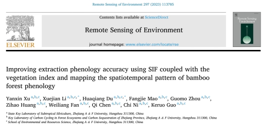
浙江农林大学省部共建亚热带森林培育国家重点实验室森林碳汇研究团队在《Remote Sensing of Environment》发表高水平论文(图)
SIF 植被指数 物候提取精度 竹林物候 时空格局制图
2024/3/5
近日,浙江农林大学省部共建亚热带森林培育国家重点实验室森林碳汇研究团队在遥感领域国际顶尖期刊《Remote Sensing of Environment》(中国科学院1区Top,IF=13.85)在线发表题为“Improving extraction phenology accuracy using SIF coupled with the vegetation index and mapping...

