
�������: 1-15 ���鵽��֪ʶ�� ��ѧ Technology����ؼ�¼488�� . ��ѯʱ��(0.109 ��)
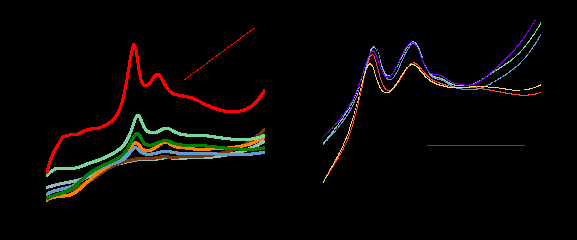
Transparent and mechanically robust Polyvinyl-alcohol nanocomposites based on multiple cross-linked networks for paper-reinforcement Technology
PVA nanocomposites Multiple cross-linking network Boron-hydroxyl coordination Blocked diisocyanate Nano-SiO2
2023/12/1
Materials based on fiber-reinforced coating have gained increasing attention due to their environmental and industrial application tracks. Polyvinyl alcohol (PVA) composites with interpenetrating cros...

�㽭��ѧ��������ԴѧԺ���ɶ���������Environmental Science & Technology�Ϸ��Ĺ����˻��ڻ���ѧϰ�����������ؽ���Ԥ��ģ�ͣ�ͼ��
���ɶ� ����ѧϰ ���������ؽ���Ԥ��
2022/10/26
�������ؽ������������Ǿ����ؽ�����������Ǩ��ת�����������յ���Ҫ���ء�Ȼ����ͨ��ʵ�鷽���ʹ�ͳ����ģ�ͻ���������ܲ�����ʱ���������÷�Χ�ȽϾ��ޡ�2021��10��14�գ��㽭��ѧ��������ԴѧԺ���ɶ��������о��Ŷ�����������˹������ѧ�Ż۴������о��Ŷ��ڻ����������֪���ڿ�Environmental Science & Technology�Ϸ�������Ϊ��Predicting Heavy Metal ...
�㽭��ѧ��������ԴѧԺ����ǿ����������Environmental Science & Technology���������������������δ��������ƣ�ͼ��
����ǿ �������� �����δ�����
2022/10/26
2021��9��24�գ��㽭��ѧ����ǿ�����о��Ŷ��ڻ����������֪���ڿ�Environmental Science & Technology�Ϸ�������Ϊ ��The trace-level sensing of phosphate for natural soils by a nano screen printed electrode�� ���о����ģ�DOI:https://doi.org/10.102...

�㽭��ѧ��������ԴѧԺ����ǿ�������ڡ�Environmental Science & Technology���Ϸ��Ľ�ʾ�����л�̼Эͬ���ƽ������γɵ����ڻ��ƣ�ͼ��
����ǿ �����л�̼ �������γ�
2022/10/26
ũ��������������ʧ������ҹ������������ˮ�帻Ӫ��������Ҫԭ��֮һ����Ŀǰ�������������γɡ��ֲ���Ǩ����������֪ʶȱ�ڣ����ۻ����ϸ�ȱ��������ʶ��2021��4��20�գ��㽭��ѧ��Դ��Ⱦ�о��Ŷ����ϵ¹�����ϣ�о����ĵȵ�λ�ڻ����������֪���ڿ�Environmental Science & Technology��IF5=8.54���Ϸ�������Ϊ ��Organic carbon linkage wi...
RESEARCH ON METHODS OF HIGH COHERENT TARGET EXTRACTION IN URBAN AREA BASED ON PSINSAR TECHNOLOGY
PS points extraction Dispersion of intensity Amplitude threshold Phase analysis Ground deformation
2018/5/14
PSInSAR technology has been widely applied in ground deformation monitoring. Accurate identification of Persistent Scatterers (PS) is key to the success of PSInSAR data processing. In this paper, the ...
RESEARCH ON COORDINATE TRANSFORMATION METHOD OF GB-SAR IMAGE SUPPORTED BY 3D LASER SCANNING TECHNOLOGY
GB-SAR Interference measurement 3D laser scanning Coordinate Transformation
2018/5/15
In the image plane of GB-SAR, identification of deformation distribution is usually carried out by artificial interpretation. This method requires analysts to have adequate experience of radar imaging...
VEGETATION MONITORING BY REMOTE SENSING TECHNOLOGY FOR UNINHABITED ISLANDS OF THE XISHA ISLANDS
the Xisha Islands Remote Sensing Uninhabited Island Vegetation Remote Vegetation Monitoring Island Development
2018/5/14
The Xisha islands are tropical coral islands in the south sea of China, with special ecological environment. As far away from the inland, they are more sensitive to climate change than inland, and are...
ANALYSIS OF LAND SUBSIDENCE MONITORING IN MINING AREA WITH TIME-SERIES INSAR TECHNOLOGY
Time-series InSAR Land Subsidence ALOS PALSAR RADARSAT-2
2018/5/15
Time-series InSAR technology has become a popular land subsidence monitoring method in recent years, because of its advantages such as high accuracy, wide area, low expenditure, intensive monitoring p...
METHODS FROM INFORMATION EXTRACTION FROM LIDAR INTENSITY DATA AND MULTISPECTRAL LIDAR TECHNOLOGY
Classification Information Extraction LiDAR Intensity Multispectral LiDAR
2018/5/15
LiDAR is a consolidated technology for topographic mapping and 3D reconstruction, which is implemented in several platforms On the other hand, the exploitation of the geometric information has been co...
A STUDY OF CO-PLANING TECHNOLOGY OF SPACEBORNE, AIRBORNE AND GROUND REMOTE SENSING DETECTING RESOURCE, DRIVEN BY DISASTER EMERGENCY TASK
Disaster Emergency Co-planning Observation Resources Mission-driven
2018/5/16
Facing the monitoring needs of emergency responses to major disasters, combining the disaster information acquired at the first time after the disaster and the dynamic simulation result of the disaste...
A REVIEW OF DIGITAL WATERMARKING AND COPYRIGHT CONTROL TECHNOLOGY FOR CULTURAL RELICS
Three-dimensional Model Copyright Protection Digital Watermarking Information Security Protection of Cultural Relics
2018/5/15
With the rapid growth of the application and sharing of the 3-D model data in the protection of cultural relics, the problem of Shared security and copyright control of the three-dimensional model of ...
STUDY ON ECOLOGICAL RISK ASSESSMENT OF GUANGXI COASTAL ZONE BASED ON 3S TECHNOLOGY
Coastal Zone Landscape Pattern Ecological Risk Remote Sensing Geographic Information System
2018/5/17
This paper takes Guangxi coastal zone as the study area, following the standards of land use type, divides the coastal zone of ecological landscape into seven kinds of natural wetland landscape types ...
COMPREHENSIVE ANALYSIS OF FLYING ALTITUDE FOR HIGH RESOLUTION SLOPE MAPPING USING UAV TECHNOLOGY
Flying Altitudes Ground Control Point (GCP) High Resolution Imagery 3D Slope Mapping UAV
2018/4/18
Unmanned Aerial Vehicle (UAV) is one of the geoinformation data acquisition technologies that popularly used for slope mapping. UAV is capable to produce high resolution imageries in a short period. I...
COMPREHENSIVE ANALYSIS OF FLYING ALTITUDE FOR HIGH RESOLUTION SLOPE MAPPING USING UAV TECHNOLOGY
Flying Altitudes Ground Control Point (GCP) High Resolution Imagery 3D Slope Mapping UAV
2018/5/8
Unmanned Aerial Vehicle (UAV) is one of the geoinformation data acquisition technologies that popularly used for slope mapping. UAV is capable to produce high resolution imageries in a short period. I...
DOCUMENTATION OF OLD TURKIC RUNIC INSCRIPTIONS OF THE ALTAI MOUNTAINS USING PHOTOGRAMMETRIC TECHNOLOGY
3D documentation Altai Mountains Digital Photogrammetry Runic inscriptions Turks
2018/3/6
Old Turkic runic inscriptions of the Altai Mountains (8th�C9th centuries AD) were digitized in the course of this project to be preserved in the current state on the Web and deciphered by linguistic ex...
�й��о����������а�-��
- ���ڼ���...
�й�ѧ���ڿ����а�-��
- ���ڼ���...
�����ѧ���л������а�-��
- ���ڼ���...
�й���ѧ���а�-��
- ���ڼ���...
�ˡ���-ƪ
- ���ڼ���...
�Ρ���-ƪ
- ���ڼ���...
��������-ƪ
- ���ڼ���...
�������� -ƪ
- ���ڼ���...
֪ʶҪ��-ƪ
- ���ڼ���...
���ʶ�̬-ƪ
- ���ڼ���...
��������-ƪ
- ���ڼ���...
ѧ��ָ��-ƪ
- ���ڼ���...
ѧ��վ��-ƪ
- ���ڼ���...